
# 5568
This is day two of 2011’s National Hurricane Preparedness Week and the focus today is on Storm Surge, traditionally the biggest cause of death from these killer storms.
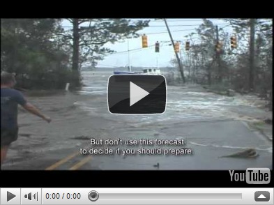
First, we’ve a video from the NHC (National Hurricane Center) on storm surge, and then I’ll return with more on SLOSH – no, not an ill-advised drinking game for hurricane parties – but the Sea, Lake and Overland Surges from Hurricanes computer model that emergency planners use to plan for coastal evacuations.
Our coast communities are increasingly vulnerable to storm surges, as the population increases. The NHC lists the following:
Surge Vulnerability Facts
- From 1990-2008, population density increased by 32% in Gulf coastal counties, 17% in Atlantic coastal counties, and 16% in Hawaii (U.S. Census Bureau 2010)
- Much of the United States' densely populated Atlantic and Gulf Coast coastlines lie less than 10 feet above mean sea level
- Over half of the Nation's economic productivity is located within coastal zones
- 72% of ports, 27% of major roads, and 9% of rail lines within the Gulf Coast region are at or below 4 ft elevation (CCSP, SAP 4-7)
- A storm surge of 23 ft has the ability to inundate 67% of interstates, 57% of arterials, almost half of rail miles, 29 airports, and virtually all ports in the Gulf Coast area (CCSP SAP 4-7)

(Storm Tide vs Surge Tide) – Credit NOAA
In order to know in advance how far inland a storm surge or tide will encroach, emergency planners run hundreds of SLOSH models for populated regions along the coast.

They vary the size, intensity, direction, and forward speed of hurricanes in the model in order to determine the worst case impact for each category of storm.
Evacuation maps and routes are then generated using this information.
This evacuation map of Pinellas County (St. Petersburg-Clearwater) Florida shows that a storm even as low as a CAT 3 could temporarily cut the southern half of the county off from the north.

Of course much depends upon the speed, direction, and point of landfall of the storm, and so not all CAT 3 storms impacting this area would produce this dramatic of an effect.
You can view a number of historical SLOSH Model runs for famous hurricanes at the following links:
As a live-aboard boater for many years on the Gulf Coast of Florida, I can attest to the power of even moderate storm surges and storm tides. They can rise suddenly, cutting off avenues of escape, and are incredibly destructive.
So, if you are asked to evacuate by your local authorities, don’t hesitate.
Just do it.